Scotland's seas: towards understanding their state
Scotland's seas: towards understanding their state.
Map
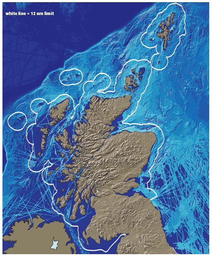
The British Geological Survey has compiled a map of the Scottish land and sea areas showing the morphology of the country's terrain. Onshore topography is from NEXTMap Britain (© Intermap Technologies) in which heights of land features are acquired from an aircraft using radar technology. The data have a very high vertical resolution. The marine dataset is part of the Olex bathymetric database compiled, processed and managed by the Norwegian company Olex AS. The seabed image is based upon echo-sounder data acquired mainly by commercial fishing vessels, but also including data from research vessels. The datasets are contributed voluntarily, the data are then individually merged with the central dataset, after which the contributor has access to all of the shared bathymetry. As a result, the data are not complete for the offshore area, but illustrate the advantages of sharing data acquired from different sources.
Contact
Email: Central Enquiries Unit ceu@gov.scot
There is a problem
Thanks for your feedback